


Community Mapping
Purpose
To enable participants to share knowledge, experiences, and visions for a specific place, identifying ecological, cultural and social features. This method supports inclusive planning, strengthens local voices, and can catalyse transformation of public or green spaces, particularly in biodiversity and justice contexts.
Key Features
Participants:
- Recommended group size: 8–50
- Suitable for age 12+
- Works well with existing groups or learning communities; introductory sessions recommended for new groups
Estimated Timeframe:
- ~2 sessions of ~2 hours
- Can be condensed (e.g. Dotmocracy - voting on ideas with sticky dots: 10–15 mins) or extended over weeks
Budget Level:
- Medium to High
- Mapping itself is low-cost, but follow-up actions (e.g. planning, campaigning, implementation) may require significant resources
Materials Needed:
- Large, printed base maps (e.g. Google Maps, OpenStreetMap, or hand-drawn)
- Visual tools: markers, stickers, photos, magazines
- Comfortable, accessible space (indoor or outdoor)
- Institutionally approved ethical information and consent forms (if collecting data)
- Refreshments
- Optional: digital mapping tools, 3D models, sensory materials
Skills Required:
- Facilitation and emotional sensitivity
- Project management and logistics
- Technical mapping or design skills (optional)
- Advocacy and campaign planning
- Ability to support inclusive, reflective dialogue
- Adaptability and ethical awareness
Case Study
Method in Practice
Context of Use
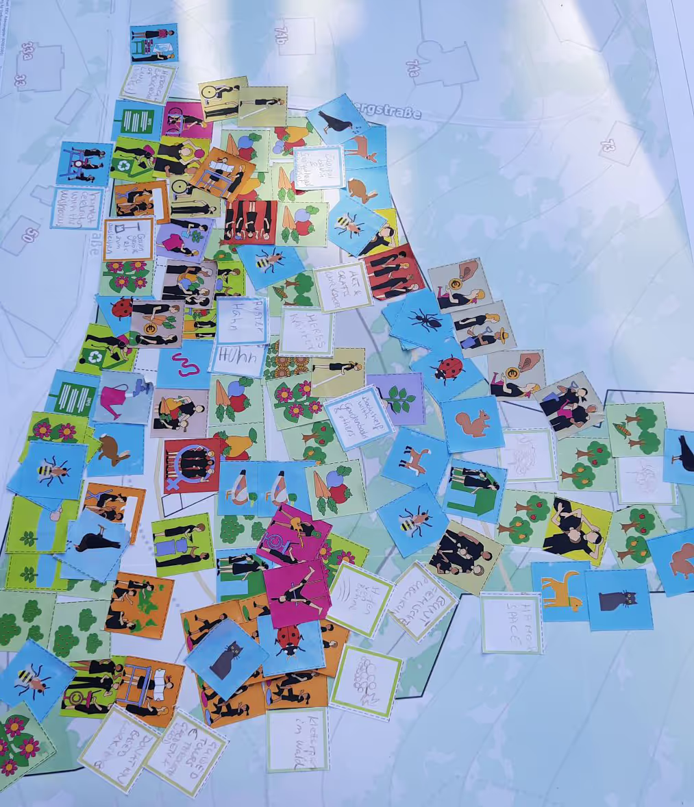
Used in the PLANET4B Austrian case study with a Learning Community of migrant women. The group mapped an unused plot near their community garden, developed a plan, and successfully negotiated with the city council to transform it into an edible, biodiverse green space.
How It Worked
Participants worked in small groups to annotate maps with ecological, cultural and social insights. They identified priorities, barriers and opportunities for transformation. The process was supported by facilitators and followed by further planning and action.
Engagement & Participation
The method encouraged collaborative visioning, storytelling and spatial reflection. Participants contributed through drawing, discussion, and mapping exercises. Facilitators ensured inclusivity, supported emotional responses and helped translate ideas into action.
Outcomes & Insights:
- Strengthened community identity and agency
- Created a shared vision for space transformation
- Enabled dialogue with local authorities
- Highlighted biodiversity priorities and social needs
- Fostered long-term stewardship and advocacy
Strengths & Considerations
Strengths:
- Visually engaging and inclusive
- Builds collective knowledge and action
- Adaptable to diverse contexts and goals
- Supports spatial justice and ecological awareness
- Can influence planning and policy
Considerations:
- Requires careful facilitation of group dynamics
- Emotional or contested topics may arise
- Follow-up support is essential for impact
- Mapping alone may not lead to change without resources or partnerships
- Accessibility and familiarity with maps must be considered
